Divide Terrain
 left click
This command divides the terrain into two parts using a closed curve and generates a zone on it. The new division or region can get a different color and material than the rest of the terrain.
Steps:
- Pick a terrain. Press Enter or right-click when done.
- Select a closed curve.
The division is created in the terrain.
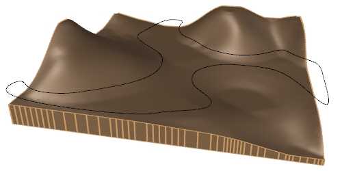
Terrain and the curve selected to create the division
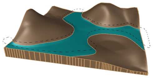
Terrain divided in two areas
Parameters
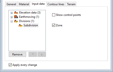
The division parameters can be edited from the Input data tab, (in the Properties area of the Edit panel or Properties Explorer dialog), under the Divisions list.
- Control points: option to enable or disable the control points of the subdivision area.
- Zone: generates a zone object in the same area. The settings are the same as those of a zone created with the laZonify command, and they can be edited from the Zone tab, in the Properties area of the Edit panel or Properties Explorer dialog, after selecting the subdivision in the Object selection list of the Edit panel or Properties Explorer dialog.
Terrain division attributes
Division attributes
The color and material of the divided area take by default the terrain attributes but they can be edited from the Material tab, in the Properties area of the Edit panel or Properties Explorer dialog, after selecting the subdivision in the Object selection list of the Edit panel or Properties Explorer dialog.
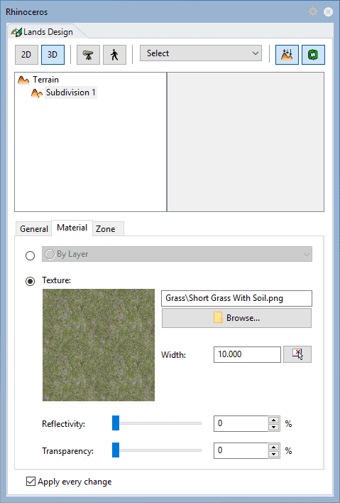
Terrain division attributes
Control points 
The control points of the terrain division let you modify the contour of the subdivision. They are the same as those of the curved used for this operation. In addition, it has a Move control arrow, to move the whole subdivision position.
These control points are integrated into the terrain and are visible when activating the terrain control points.
They can be disabled from the Input data tab, (in the Properties area of the Edit panel or Properties Explorer dialog), after selecting the subdivision under the Divisions list.