Document Properties
The document properties only affect the current document and they are available from two different places:
- Edit Panel > Properties area, (when no object is selected)
- Rhino Options: Tools > Options > Document Properties > Lands Design > Layers
The document properties are arranged in different tabs (in the Edit panel) or sections (in Rhino Document Properties):
Document
This section lets you choose the plant 2D and 3D display modes in the model.
Billboards
When the Plant 3D display is set to Realistic, the 3D plants are replaced by billboard representations according to the distance they are from the viewer position. The billboard representation has no effect on render views.
Season
It defines the current season for the document. Plants will be rendered according to this season unless they have a different one set by each element.
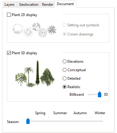
Document Properties tab in the Edit Panel
Layers
This tab shows the list of different Lands element types and the layer where they are created when they are being inserted in the model. When a new object type (plant, terrain, Sprinkler, etc..) is inserted for the first time, a new layer is created for that object, and the Layer Edit Button switches from  to
to  .
.
- The object will be generated in the indicated layer. When the layer is set to None, the object is created in the current Layer.
- The object will be generated into a new layer created automatically according to the Layer settings in the Lands Options dialog. The name and color of the new layer can be edited there. (If the button next to each object type is unchecked, the object will be created in the current layer.)
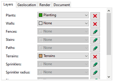
Layers tab in the Edit Panel
Geolocation
This tab lets you define the model's drawing coordinate origin (0,0,0) in latitude, longitude, and elevation. It can also be edited using the EarthAnchorPoint command, or from the Rhino Document Properties > Location (in Rhino Options dialog).
New documents have no specific location defined and they get one when importing a terrain with the laEarthScan command, or when editing the geolocation values manually.
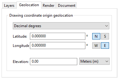
Geolocation tab in the Edit Panel
Render
The render properties determine the way the vegetation species will be rendered.
- Generate plants as seen in the drawing: plants will be rendered according to the global season set in the file or to the vegetation elements in the model.
- Generate very detailed plants for the render: plants will be rendered according to its appearance linked with the season selected and the Growth option. The maximum growth corresponds to the current height/age of each vegetation specimen in the model.
Assign texturized materials to Lands objects when creating them: so they are ready for a quick render of the scene.
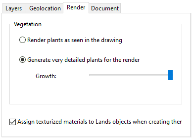
Render Properties tab in the Edit Panel