Terrain Pick Boundary
 left click
Specifies a closed curve to define the terrain boundary.
When the Delaunay triangulation algorithm is used without a grid, the limits of the terrain surface correspond to those of the triangulation obtained. When the terrain is generated by lifting the grid points, the limits of the terrain surface will be determined by the minimum rectangle that contains the plan projection of all input curves and points.
Steps:
- Pick a terrain.
- Select a closed curve to define the new terrain contour.
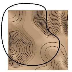
Existing terrain with the curve to define the new boundary
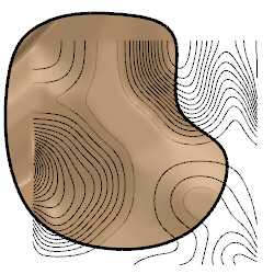
Terrain with the new boundary in the Top viewport
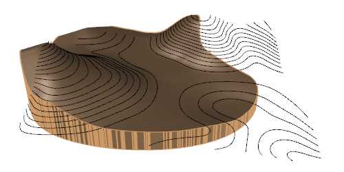
Terrain with the new boundary in the Perspective viewport
The new boundary can be removed using the  laTerrainRemoveBoundary command or from the Terrain Edit area of the Edit panel and Properties dialog, under the Input data tab, after selecting the terrain.